Hiking Guide: The Crete E4 Trail
I distinctly remember the moment, another long stretch down another paved road in what would have been a great landscape for walking if not for the hard asphalt underfoot and the occasional car flying past much too fast on a dodgy curvy mountain road. A moment when I thought to myself: “This sucks. I’m done here.” The Crete E4 trail crosses incredible landscapes and backcountry villages, olive groves and astonishing gorges, and yet I hated almost half the time I spent walking the thing.

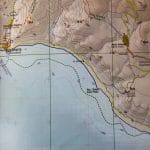
I didn’t finish the E4 trail. Not even close. Part of this was due to the weather so early in the season, and the lack of a good map was also a major contributing factor. More than anything, though, the fact that the Crete E4 is only rarely signposted meant that I spent just as much time along roadways as I did on proper trails was the determining factor. Here, then, is the information I wish I’d had from the beginning:
Hiking Guide: The Crete E4 Trail
I went with a road atlas that was nowhere near detailed enough to orienteering effectively. If I could do it again, I would either take along my copy of The High Mountains of Crete or pick up several of the more detailed 1:100,000 Anavasi maps of Crete. Their shop in Athens doesn’t have a complete selection, so consider getting these before you leave home if possible.
As I was sitting in America waiting on a recently-surgered bone to heal, one of the experiences I was most looking forward to upon leaving the country was a planned three week hike across the Greek island of Crete on the E4 trail. Planned as a single hiking path across the breadth of Europe, the E4 in Crete is meant to cover the island’s highest mountains and most beautiful beaches as it explores less-visited parts of the country well away (at times) from the tourist highlights.
Unfortunately, given the level of development of the island, it also spends quite a lot of time on dusty roads trudging up and over mountain passes and down through village fields. Though at times presenting beautiful vistas, 5 days of spending two hours on a trail and four hours on a road had me immediately reassessing my plan. Given that my map’s scale wasn’t detailed enough to attempt an off-trail crossing of the island, I decided to give it up only a few days in.
Heading back from the east of Crete to Kyle’s house in Chania, I re-packed my bags and headed for the southwest coast, which my map showed to be much higher on beautiful trails and much sparser with time spent hiking Crete’s highways.
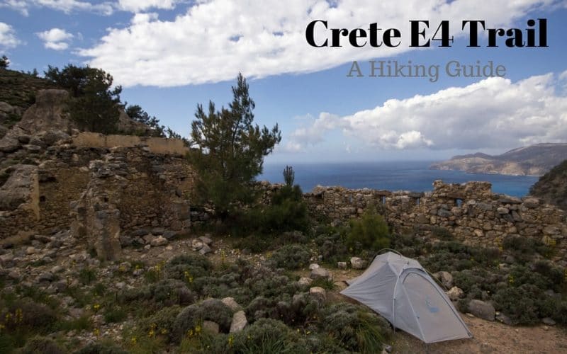
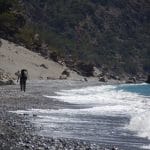
It was beautiful! Beaches, mountains, fortresses, and hillsides full of wildflowers.
Western Crete was everything a long-distance hike should be. Beautiful stretches of nature with the occasional veer towards inhabited areas for re-stocking supplies and maybe buying a hot meal or cold beer. Mostly, though? Amazing views and and beautiful campsites for two weeks on the southern coast.
More photos and write-ups to come, but for now a couple of photos:
—–
This is an overview of my trip hiking the Crete E4 trail. For more detailed info, check out some of these posts:
Starting the Crete E4.
Hiking Elafonisi to Paleochora
Paleochora to Sougia and Tripiti
Cave Camp
Samaria Gorge
Hiking from Agia Roumeli
Snowy Lefka Ori
Likos Taverna
Loutro and Sfakia
Resting at Fragokastello
Dead’s Gorge and Zakros
Passing through Sitia
You’ll notice that I didn’t finish the E4 trail. Part of this was due to the weather so early in the season, but the lack of a good map was also a major contributing factor. I went with a road atlas that was nowhere near detailed enough to orienteering effectively. If I could do it again, I would either take along my copy of The High Mountains of Crete or pick up several of the more detailed 1:100,000 Anavasi maps of Crete. Their shop in Athens doesn’t have a complete selection, so consider getting these before you leave home if possible.
One more thing to note: the public transit doesn’t run all that often to smaller towns and you may get stuck en route. I ended up spending more than I wanted at Sitia for a hotel for the night – check for cheap hotels in Crete before you head out if you want to avoid the same.
Also read:

Nice work Stephen! While living in Madrid for 3 years I ticked off as much of the 10,000km E4 route I could!! The Southwest section of Crete was by far the best and I can’t find the guide book at the mo that I used but yes, maps were hard to come by back in 2005 when I did it!
My suggestion for you in Australia is The Heysen Trail. 1,200km in South Australia! Well marked and maintained through out! approx 50days!